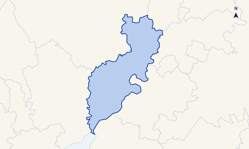
This page brings together the boundary map, contact details and official source links for planning applications handled by Forest of Dean in England (ONS code E60000310).
What to do next
Three steps before you submit
Start with Forest of Dean's current requirements, then prepare the right map and decide whether you need professional help.- 01
Check the official requirements
Read the published planning-map or validation guidance for Forest of Dean before preparing the drawings.
Open official guidance ↗ - 02
Create the right planning map
Once you know what is required, create a location or block plan for the site at UKPlanningMaps.com.
- 03
Decide whether you need professional help
If the boundary, access, proposal or drawing pack is complicated, compare businesses that publish coverage for Forest of Dean.
View professional help ↓
Official guidance check
What Forest of Dean says about planning maps
The information below is from the Forest of Dean website. We have presented its published advice about location plans, site location plans, site plans and block plans as a plain-English summary, checked on 17 August 2026.
Location plan and site location plan
- Forest of Dean asks applicants to provide a location plan or site location plan with the application drawings.
- The location plan scale is 1:1,250.
- A 1:2,500 scale may be used where it suits the site.
- The application site should be edged or outlined in red.
- Other land owned or controlled by the applicant should be shown in blue where relevant.
- A north point or direction of north should be shown.
Site plan and block plan
- Forest of Dean asks applicants to provide a site plan or block plan showing the property and proposal in more detail.
- A 1:200 scale may be used for the detailed plan.
- A 1:500 scale may be used for the site or block plan.
- The detailed plan should show the direction of north.
- The plan should show existing buildings, the proposed work, access, trees and hedges, neighbouring land and buildings.
This is our summary, not a substitute for the authority’s current validation list. Follow the source link before submitting because requirements and documents can change.
Architectural technologist
Listed as covering England
Architect
Listed as covering England
Shown from our directory according to published coverage. The directory is independent of the businesses listed; these are listings, not recommendations or endorsements.
Find a local professional in our directory.Planning-map essentials
Which map should you prepare for Forest of Dean?
Many applications use two complementary drawings: a location plan to identify the land and a block or site plan to show the site and proposal in more detail. The application type and local validation list determine what else is needed.
Wider site contextLocation plan
Shows the application site in its surroundings, commonly at 1:1,250 or 1:2,500. The red line must identify all land forming the application site, including relevant access.
Read the location-plan guide →Detailed site viewBlock or site plan
Shows the site, buildings, boundaries, access and proposed work in more detail, commonly at 1:200 or 1:500.
Read the block-plan guide →Scale and outputChoose and print the scale
Choose a scale that clearly shows the necessary context, then print the original PDF at its stated paper size using Actual size or 100%.
Compare planning-map scales →Print a map to scale → - Current, correctly licensed map base
- Recognised metric scale
- North point and scale bar
- Red application boundary
- Blue ownership boundary where relevant
- Enough context to identify the site
These guides explain the general principles. Before submitting, use Forest of Dean's official website to find its current validation list and application-specific requirements.
Questions about maps for Forest of Dean
What location plan should I submit to Forest of Dean?
Use a current, licensed map at a recognised metric scale with the application site clearly outlined in red, other nearby applicant-owned land in blue where relevant, a north point and enough road and building context to identify the site. Check Forest of Dean's current validation requirements for the final specification.
Is a site location plan the same as a location plan for Forest of Dean?
Yes. The two terms normally describe the wider map used to identify the application site, commonly at 1:1,250 or 1:2,500.
What is the difference between a site plan and a block plan?
The terms are often used for the same closer, detailed plan. It commonly uses 1:200 or 1:500 and shows the site layout, buildings, boundaries, access and proposed work.
Can I use an OS plan for a Forest of Dean application?
Ordnance Survey mapping is commonly used as a detailed base for planning maps, but the finished document still needs the correct scale, boundary, context, paper size and planning-use licence.
What if my planning map does not print to scale?
Match the PDF sheet size to the printer paper, select Actual size or 100%, turn off Fit or Scale to fit, then measure the printed scale bar. Do not stretch the PDF.